SUNDAY, APRIL 7, 2013
Bill Huston
Introduction:
1: Exxon Mobil combats the “LIES” of the radical anti-fossil fuel extremists,
who by strange coincidence, happen to agree with many industry sources.
2: Several Major Cities downstream from this site.
Drinking water for ~900,000 people may be at risk.
3: Hedge your ExxonMobil stock with Georgia Pacific
4: UPDATE: 4/8/2013 Accurate map of Pegasus Pipeline though Arkansas
Please also see my prior post on the Mayflower ExxonMobil spill.
Narrative:
1: ExxonMobil gets upset about all the “lies” being told…
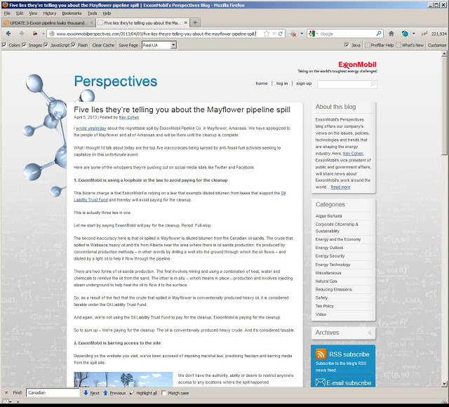
ExxonMobil says the radical Anti-Fossil Fuel Activists are spreading LIES!
Detail:
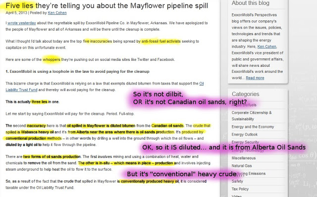
But even the Exxon Mobil PR person seems confused.
It’s a LIE that it’s Diluted Bitumen from Alberta Tar Sands!!!
OK, it’s from NEAR the Tar Sands region.
And it is Diluted. Well, OK it is from Tar Sands. But it is CONVENTIONAL HEAVY CRUDE!!
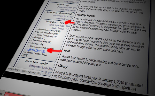
Crudemonitor.CA says nope: Wabasca Heavy is Dilbit. Maybe they’re radical tree-huggers.
More:

Industry consultant: Wabasca Heavy = Diluted Bitumen
Declaration of Ronajit Sahu on MN PUC Enbridge application Alberta Clipper
Maybe an Anti-fossil fuel radical?
Another:
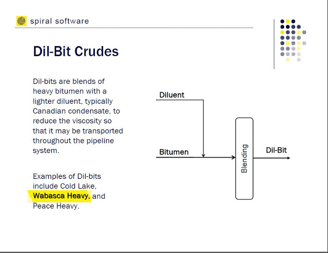
Industry presentation: It’s Dilbit.
From “Understanding the Quality of Canadian Bitumen and Synthetic Crudes“,
by Pat Swafford, Spiral Software Limited
Crude Oil Quality Group Meeting, February 26, 2009
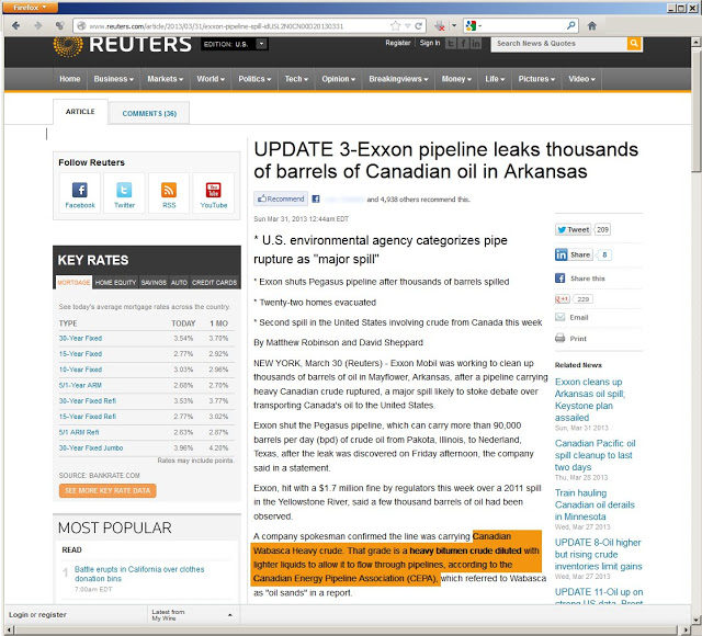
Known Liberal News Source Reuters (sarcasm)
Wabasca Heavy Crude = Dilbit
“UPDATE 3-Exxon pipeline leaks thousands of barrels of Canadian oil in Arkansas”
Maybe ExxonMobil is confused about who is lying….
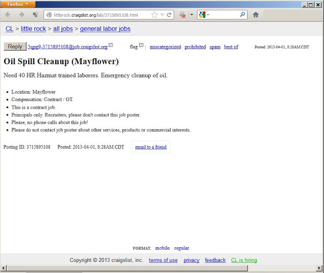
Hey at least there will be JOBS!!!
See also this article from Scientific American which discusses some other issues, including the corrosivity issue discussed on the ExxonMobil blog.
2: Arkansas Watershed Information
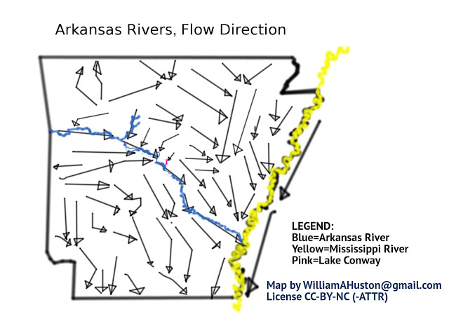
Arkansas Rivers — Flow Direction
Pink X (center) is site of spill
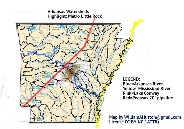
Arkansas Watersheds, highlight: metro Little Rock.
Pegasus Pipeline leak occured at Lake Conway
(pink X just north-west of Little Rock)
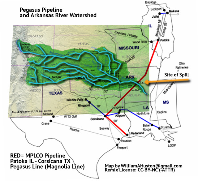
Pegasus Pipeline, Arkansas River Watershed
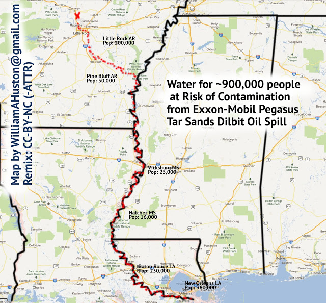
Drinking Water for ~900,000 people at Risk of Contamination
See also: “Arkansas Water System to Ask Exxon to Move Its Pipeline”
3: ExxonMobil and Georgia Pacific:
an investment match made in H—- ???
Check if your Mutual Fund includes BOTH Exxon-Mobile and Georgia-Pacific
— makers of Brawny Towels!
made from GENUINE FRESH PULPED FORESTS and cured with CLEAN BURNING NATURAL GAS (from Dimock PA).
G-P makes a good hedge on your ExxonMobil stock.
Part of Koch Industries, Inc., makers of the Tea Party Patriots and ALEC
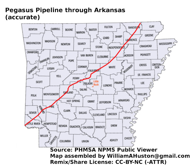
Here it is– the ONLY accurate map of the Pegasus Pipeline
through Arkansas on the Internet.
Painstakingly assembled from the NPMS Public Viewer.
Please resuse any of my content under CC-BY-NC (with attribution).
Commercial License is Available: Please contact me
Posted by Bill Huston at 6:07 PM
republished with permission